Pennsylvania Water Science Center
Select a streamflow gaging station (a table of stations is shown below the map). Only stations within the Philadelphia County map are active.
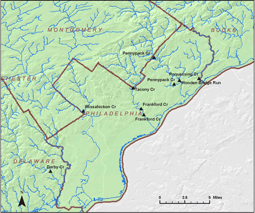
Station ID |
Station Name |
County |
Period of Record |
Drainage Area, mi2 |
| Wissahickon Creek at Mouth Philadelphia | PHILADELPHIA | 1966-2001 | ||
| Frankford Creek at Torresdale Ave Phila | PHILADELPHIA | 1966-1980 | ||
| Wooden Bridge Run at Philadelphia | PHILADELPHIA | 1966-1980 | ||
| Tacony Creek at County Line Philadelphia | PHILADELPHIA | 1966-1985 | ||
| Frankford Creek at Castor Ave Philadelphia | PHILADELPHIA | 1983-2001 | ||
| Pennypack Creek at Pine Road at Philadelphia | PHILADELPHIA | 1965-1980 | ||
| Poquessing Creek at Grant Ave at Philadelphia | PHILADELPHIA | 1966-2001 | ||
| Pennypack Cr at Lower Rhawn St Bdg Phila | PHILADELPHIA | 1966-2000 |

![]() U.S. Department of the Interior |
U.S. Geological Survey
U.S. Department of the Interior |
U.S. Geological Survey
URL: http://pa.water.usgs.gov/apps/recharge/counties/philadelphia.html
Page Contact Information: Pennsylvania WSC Webmaster
Page Last Modified: Thursday, 02-Feb-2012 09:56:37 EST

